Driving Utah’s Alpine Loop: Know Before You Go
Updated:
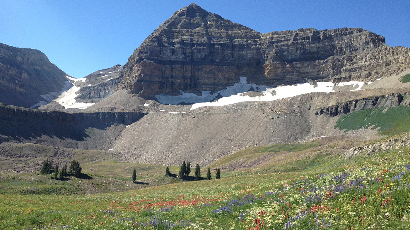
Looking to check out Utah’s beautiful Alpine Loop Scenic Byway? Make it a safe and fund drive by getting details here before you go.
Winding 20 miles through the glacier-carved peaks of the Wasatch Range, this paved route places you below 11,752-foot Mount Timpanogos and its limestone cliffs, linking American Fork Canyon to Provo Canyon. Along the way, you’ll pass aspen groves, alpine waterfalls, and popular hiking trails.
Here’s everything you need to know if you’re looking for a casual weekend drive, hunting for fall foliage, or packing your day with outdoor adventures.
Quick Facts & Logistics
- Route: Utah SR-92
- Route: Utah SR-92
- Distance: ~20 miles (one-way loop connecting US-189 in Provo Canyon to SR-92 in American Fork).
- Drive Time: 1 hour without stopping, 3 to 6 hours with scenic stops and light hiking.
- Passes & Fees: Driving straight through without stopping is free. However, if you park at any trailhead, picnic area, or recreation site, a $10 Uinta-Wasatch-Cache National Forest Pass or an America the Beautiful Pass is required.
- Season: Late May through late October (closed in winter due to snow).
Road Conditions & Vehicle Restrictions
While the Alpine Loop is entirely paved, it is not a multi-lane highway. The road is narrow, steep, and full of sharp switchbacks and blind corners.
Vehicles longer than 30 feet (including RVs and trailers) are prohibited for safety. The turns are tight, and pulling a trailer on these grades can easily lead to stuck vehicles or other hazardous situations.
Standard passenger cars, SUVs, and motorcycles generally handle the road fine, but there are no center-line markings on long stretches.
👉 Drive slowly, stay in your lane, and watch for cyclists making the climb!
Best Time to Drive
The experience on the Alpine Loop shifts depending on the season:
- Summer (June – August): This is a great time of year to enjoy the mountain air, vibrant forest canopy, blooming wildflowers, and peaceful hiking trails.
- Fall (Mid-September – Early October): Thousands flock to the loop to witness the quaking aspens and gamble oaks.
- 🚫 Winter: The Alpine Loop typically closes in late October or November between Pine Hollow (MP 14) and Aspen Grove (MP 22). The road typically reopens in late May or early June, depending on snow and maintenance resources. During winter, vehicles can still access destinations like Sundance Mountain Resort (via Provo Canyon) and Tibble Fork Reservoir (via American Fork Canyon), but conditions are challenging in winter weather and the Traction Law can go into effect at any time.
- Spring (Late May): The road typically reopens as snow clears. Waterfalls like Stewart Falls are roaring with snowmelt, though higher trailheads may still have snow patches.
Because of its proximity to Salt Lake City and Utah Valley, fall weekends on the Alpine Loop may be full of bumper-to-bumper traffic. Aim for a sunrise drive on a weekday to get the aspen tunnels all to yourself.
👉 Please obey all posted parking signs. Illegally roadside parking is a safety hazard and makes it difficult for emergency vehicles to pass.
Top Stops Along the Way
Timpanogos Cave National Monument
Located near the mouth of American Fork Canyon, this site offers guided tours through underground caverns featuring intricate stalactites and stalagmites.
The cave system is accessible only through guided tours managed by the National Park Service. Reaching the cave requires a steep, 1.5-mile paved hike with 1,092 feet of elevation gain.
👉 Advanced ticket reservations to the monument are highly recommended. Visit thethe monument’s official site to learn more.
Tibble Fork Reservoir
A short detour off the main loop via American Fork Canyon, this mountain reservoir is surrounded by pine trees and peaks. It’s a popular spot for stand-up paddleboarding, kayaking, or a quick waterside picnic. Motorized boating is not allowed.
Cascade Springs
A couple of miles off the loop via FR-114, Cascade Springs features natural pools, cascading waterfalls, and shallow streams filled with cutthroat trout. A series of paved boardwalks makes this an easy, accessible stop for all ages.
Stewart Falls & Aspen Grove
Starting near the Aspen Grove trailhead on the Provo Canyon side, the 3.5-mile roundtrip hike to Stewart Falls leads to a 200-foot two-tiered waterfall nestled into the side of Mount Timpanogos. Even if you don’t hike, driving through the Aspen Grove section during peak autumn offers some of the best foliage views in the entire state.
Sundance Mountain Resort
End (or start) your journey at Sundance Resort. Founded by actor Robert Redford, this mountain resort offers lunch, lift rides up the mountain, and a variety of recreation activities.
👉Please obey all posted parking signs and watch for pedestrians and cyclists throughout the canyon when you travel to Sundance.
Essential Tips
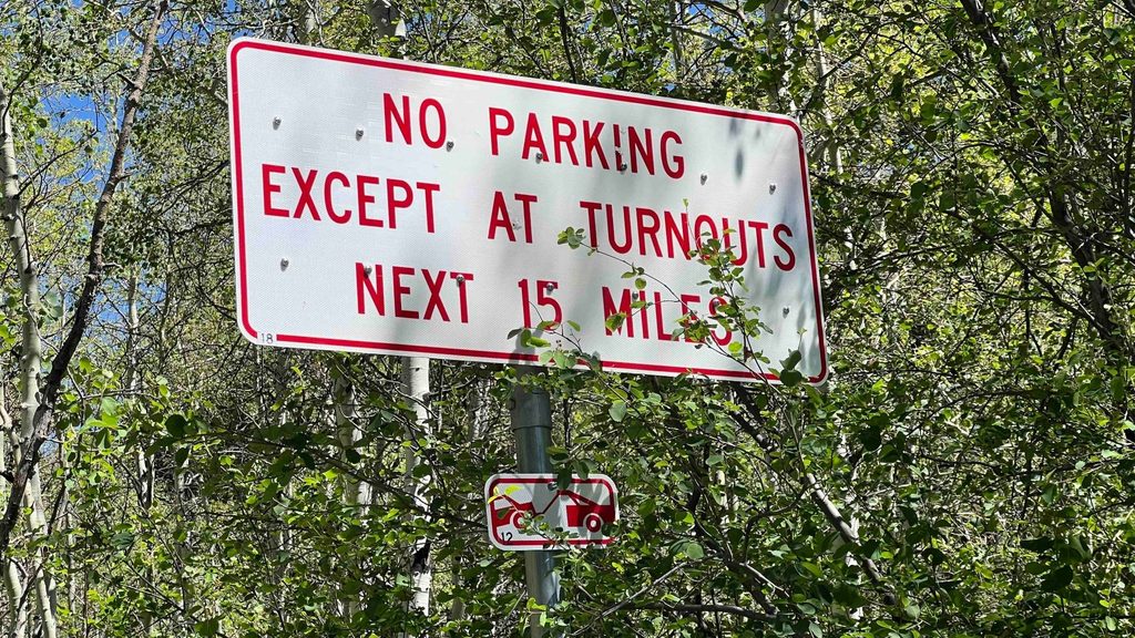
To have a safe and enjoyable drive along the 20-mile Alpine Loop, keep these tips in mind before heading into the canyon.
- Obey all posted parking signs. Park only in designated areas and do not park in the travel lanes.
- Have a Plan B: Parking is restricted to designated pullouts and lots, which often fill during peak times such as summer weekends. If your destination is full, you must go somewhere else. Illegal roadside parking impedes emergency vehicle access, and your vehicle can be ticketed and towed.
- Fill Up: There are no gas stations along the 20-mile stretch between American Fork and Provo Canyon. Make sure your tank is full before leaving the highway.
- Download Maps Ahead of Time: Cell service is notoriously spotty or nonexistent once you enter either canyon. Download your trail maps, driving routes, or playlists offline.
- Watch for pedestrians: Hikers and campers may cross the road to access trailheads and campgrounds. Be alert.
- Pack Layers: Temperatures at the summit (Summit Trailhead reaches nearly 8,000 feet) can easily be 15–20 degrees cooler than down in the valley.
- Leave No Trace: Please pack out all trash, respect wildlife, and stay on marked trails to protect the alpine ecosystem.
Share: